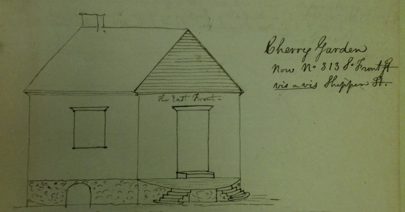
To summarize, we have a 1716 treasure map from Philadelphia that leads to a particular small brick building in Cherry Garden, leading downwards from the southeastern corner of Society Hill to the Delaware River.
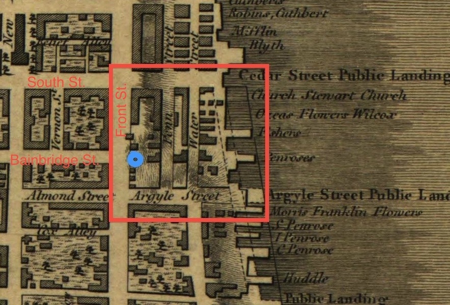
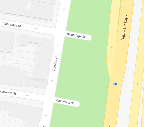
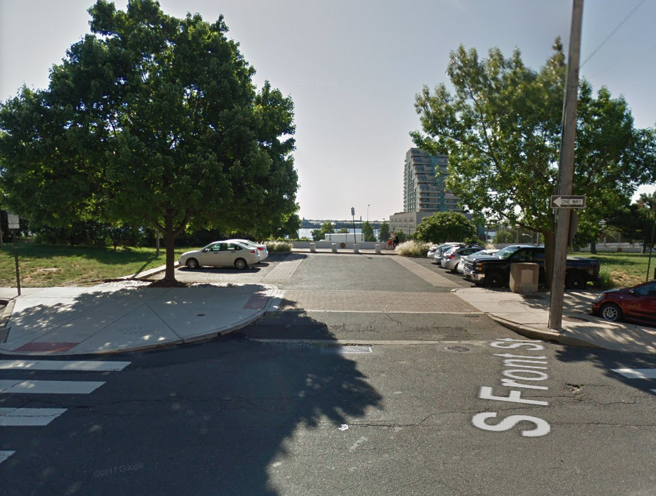
In the early 18th century, Cherry Garden was (as its name suggests) gardens, apart from a single building: while in the 21st century, the whole area East of South Front Street is now empty, save car parks and grass verges that were cleared during the construction of the Interstate I-95. All of which might possibly trick you into thinking that this land has always been empty of buildings.
But if you did, you’d (of course) be wrong. And here’s why…
The 601 Block
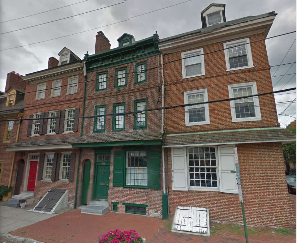
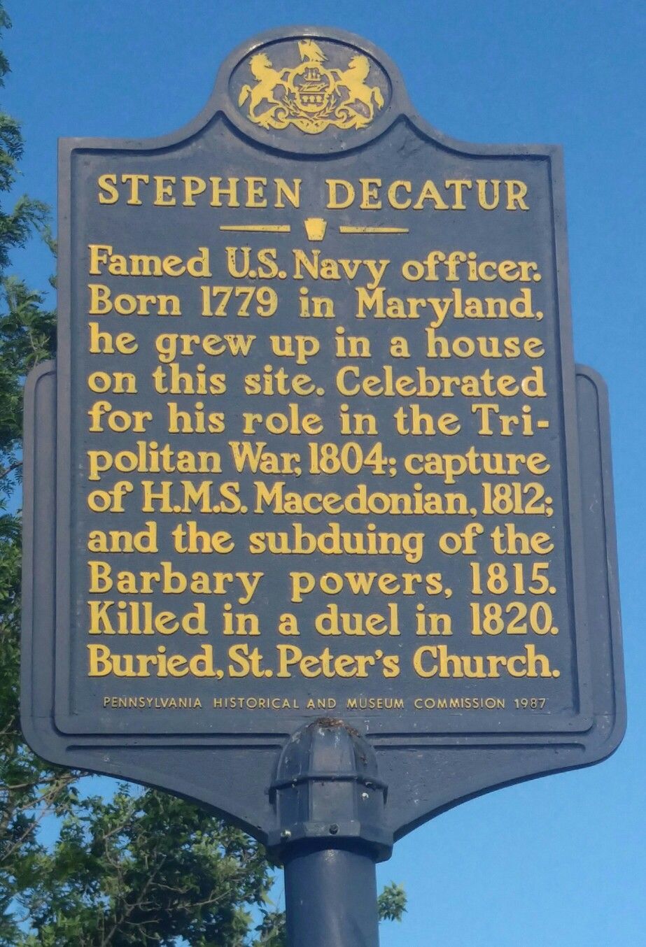
In the previous post, we saw how Commodore Stephen Decatur (1779-1820) grew up on what is now South Front Street’s 600 block. According to this 1935 source, Stephen Decatur’s “father’s home in 1801 was No. 261, now No. 611 South Front Street”. (p.137)
More recently, there was also the (now long-demolished) John Hart House at 601 South Front Street:
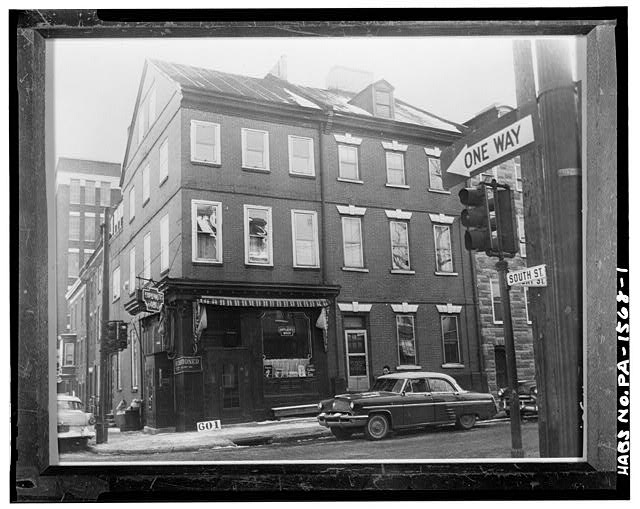
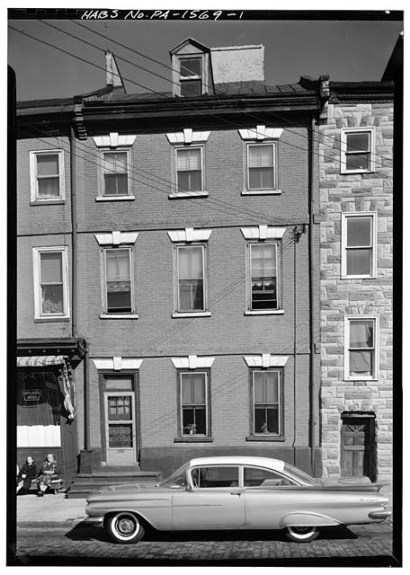
The same source also has a nice picture of 603 South Front Street:
The 701 block
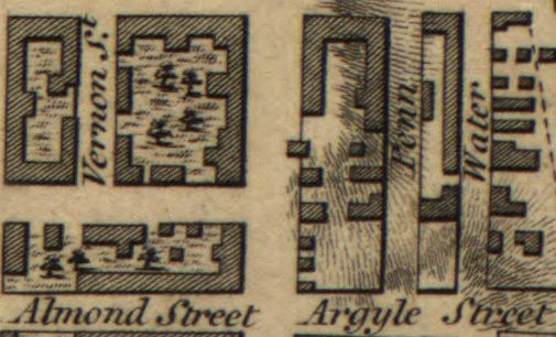
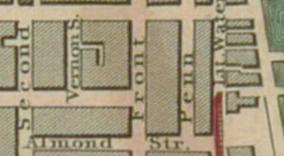
As late as the 1840 map of Philadelphia, Shippen Street only went as far East as Front Street:
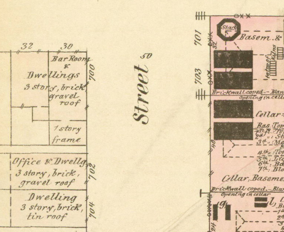
But by the time the area block appears in Ernest Hexamer’s 1860 map of Philadelphia, the long block has been divided into the 601 block and the 701 block. Here, the 701 block is – just like the 601 block a few feet to the North – full of tightly packed houses:
Hence we can see that this is not a nice Roman villa under an undisturbed field scenario: rather, there is already a nice load of archaeology to potentially be contended with here.
The Franklin Sugar Refinery
When a sea-change in business hit Philadelphia in the second half of the 19th century, this part of the city was transformed: and the incoming tide was one of white sugar, or (rather) the need to build a refinery to produce white sugar. This was the Franklin Steam Sugar Refinery (later the Franklin Sugar Refinery): there’s a nice 2013 article on the company courtesy of The Inquirer (philly.com), which includes details of how the company kept its refining tricks secret:
[…] in order to mystify New York refiners eager to learn its trade secrets, it was equipped with a Willy Wonkalike room crammed with pipes and valves that was entirely a sham; the valves would regularly be opened and closed to no actual purpose, their job simply to throw industrial spies off the scent.
In the 1872 map, we can see the changes to the building on Front Street, together with the Widow Maloby’s Tavern on the opposite corner (700 South Front Street):
We can also see clearly the relative offset between Widow Maloby’s Tavern (at 700 South Front Street) and the northwestern corner of the Franklin Sugar Refinery building complex:
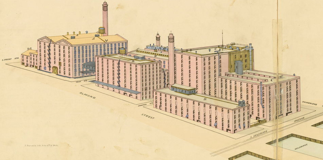
By 1886, we can see (again, thanks to Ernest Hexamer) the sugar refinery’s building sprawl:
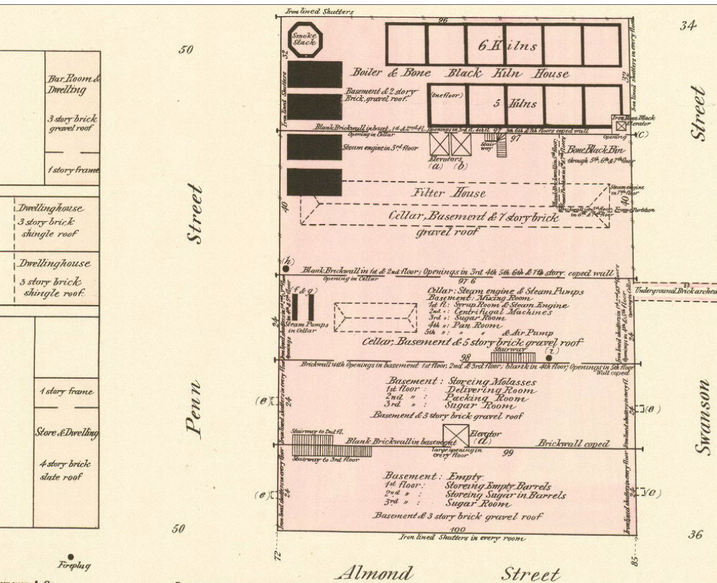
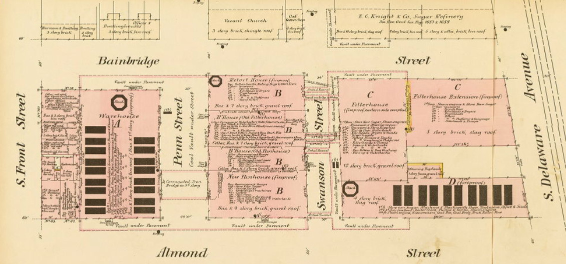
Here’s the matching ground plan, which includes lots of cellarage because the site was built upon a slope going down to the Delaware:
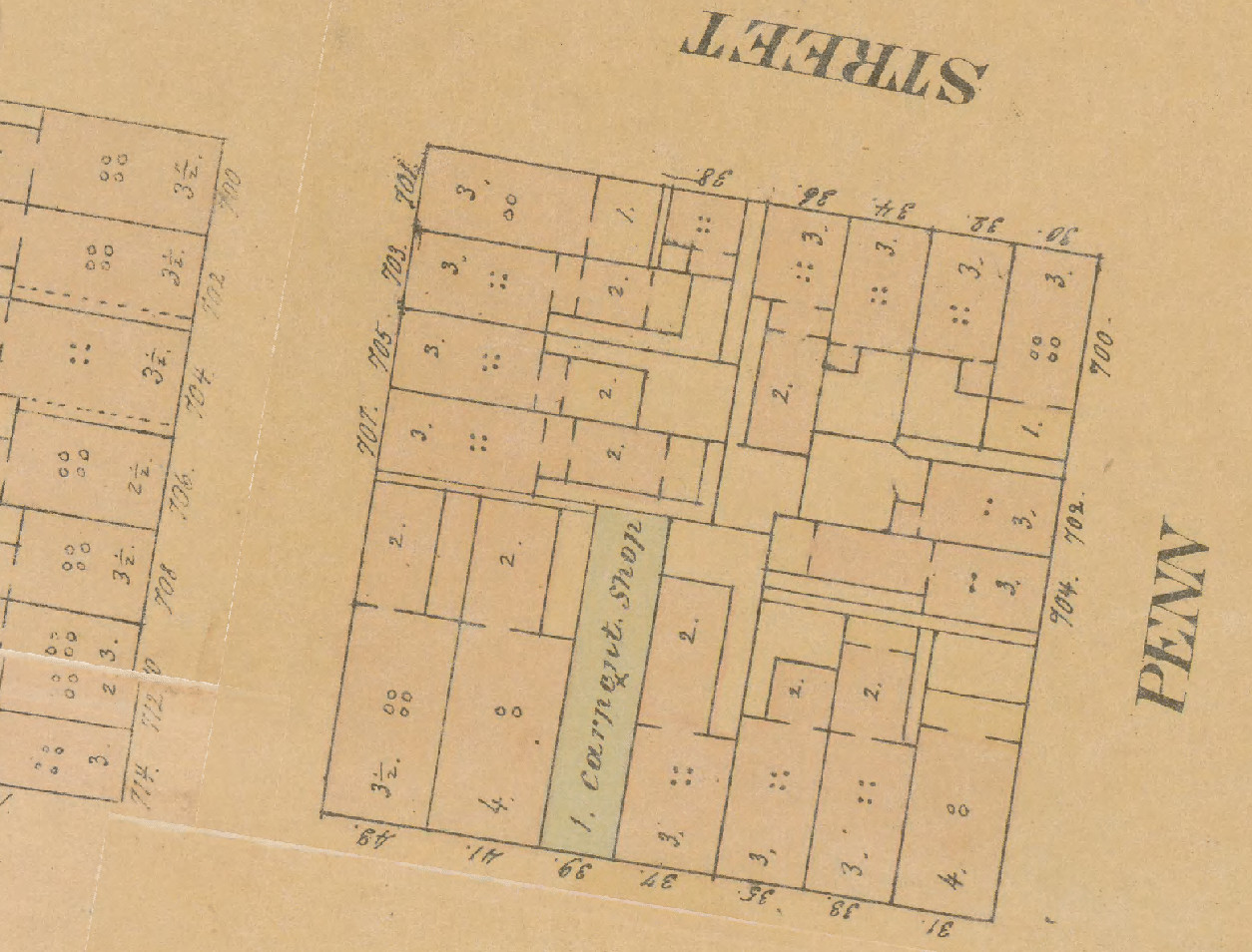
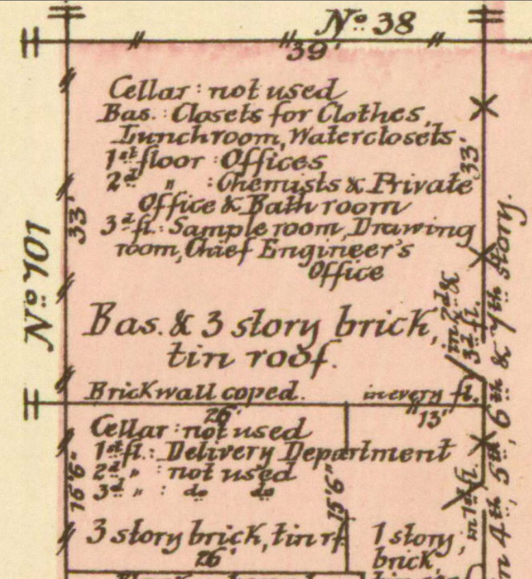
And here’s a closeup of the 701 block in 1886, with South Front Street on the left:
When The Molasses Run Dry…
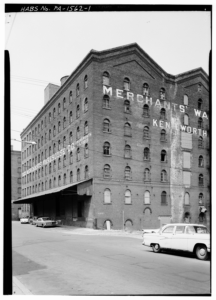
Of course, despite the sugar rush, all good things must come to an end: and so the buildings on South Front Street became warehouses in the 20th century:
The building itself was demolished in 1967, and the by-now-more-than-somewhat-run-down area was flattened and cleared to make way for Interstate I-95: which is the state in which we find it now.
So, Where Do We Start The Geophys?
From my perspective, it seems as though the 701 (top left) corner of the site goes right over the site of the building facing Shippen Street in the early maps. So it looks to me as though the 701 block was built right on top of the cottage we’re looking for. There may just be a small piece of the original sticking out to the North, but this is perhaps a little unlikely.
So there doesn’t seem to be much hope of finding the cottage. However, locating the top-left corner of the factory building would be a nice confirmation of where things were (though note that we also know that South Front Street was 50′ wide at this point).
As a reminder of the original letter:
9 – Measure exactly 45 foot from that Porch along the lane due South
10 – there you will find a Stone post in the ground if not moved which may
11 – be easily done by accident or perhaps by makeing a Neu fence : 3 foot
12 – or perhaps 4 foot west from the s[ai]d stone is a Chist 4 and a half foot long 2 foot
13 – broad and half foot and the same depth accordingly being about 6 foot from the
14 – bottom of the Chist to the surface of the Ground.
As described here, it seems to me that the “Stone post” / “Neu fence” is almost certainly a boundary marker: and it also seems likely to me that the 50′ width of South Front Street is something that was measured out right in the earliest days of the town. As a result, all the building work to the East of South Front Street would have been carried out strictly behind that boundary marker.
Hence I think there is a good chance that the “Chist” described in the letter was buried beneath South Front Street itself, in the days long before tarmac and modern road construction. And who’s to say that it isn’t still there? 😉